


Liquid earth: UAA researchers study earthquake models
by Joe Selmont |
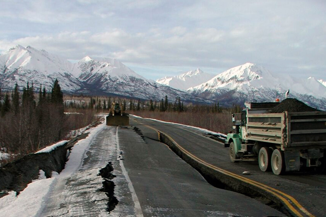
In 2002, a large earthquake (Mw=7.9) struck in the Alaska Range near Tok, inflicting severe infrastructure damage to two sites: the Tok Cutoff highway near the Slana River and the Northway Airport by the Canadian border. This may sound like old news, but in UAA’s College of Engineering, researchers are still uncovering valuable findings from this disaster — findings that may help the Alaska Department of Transportation & Public Facilities (AKDOT&PF) better prepare for future earthquakes.
“Essentially, the soil beneath the pavement liquefied during the strong ’02 quake,” said Joey Yang, Ph.D., professor of civil engineering and lead researcher on this project. “This often happens when soil is loose and waterlogged, like glacial silt. The liquefied soil spreads out, behaving a lot more like water than earth, and then there’s suddenly nothing solid beneath the pavement to support it, causing it to move sideways and crack apart under its own weight.”
This process is known as liquefaction-induced lateral spreading. The term may seem abstract, but the consequences can be deadly concrete. For example, much of the death and destruction caused by the 2011 earthquake in Christchurch, New Zealand, and the 1964 earthquake in Alaska were due to the soil liquefying beneath buildings and other structures.
Appropriate precautions can prevent the worst impacts of earthquakes. But to prepare for disasters, you first need to understand the risks.
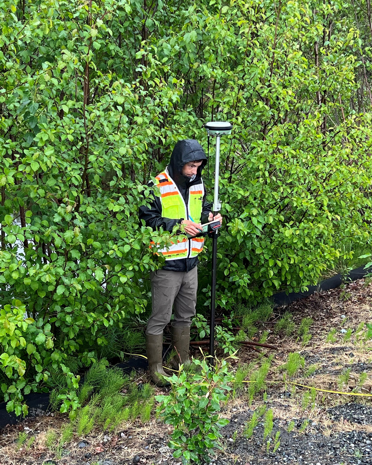
UAA grad student in the field
“AKDOT&PF currently uses one model to estimate liquefaction-induced lateral spreading, but we’re hoping to point them toward more accurate models,” said Dave Eibert, a master’s degree student in civil engineering. He is working as Yang’s research assistant on this project, and it is also the subject of his thesis project.
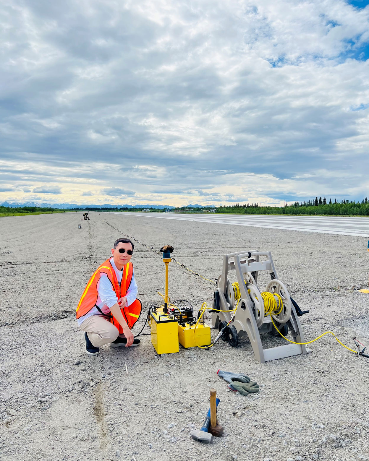
Eibert traveled to the Slana River and the Northway Airport to take samples of the soil for analysis back in the lab. During that same trip into the field, several standard penetration tests were conducted, a deceptively simple procedure that provides important data about the properties of the soil.
“You basically use a big, automated hammer to advance a tube into the ground,” he said. “The resistance the sampler encounters while advancing through the soil can reveal many of the soil properties at a given depth. The resistance is measured by counting hammer blows to the sampler for each six inches of penetration. This value is referred to as a blow count.”
The blow count provides important data used in models to estimate the amount of lateral spreading that might occur during an earthquake. This estimate influences infrastructure decisions and helps engineers answer questions like: Will this site be more or less stable than a different site? What kind of structural supports are necessary to build safely?
However, there are competing models that may work better or worse depending on the conditions in a particular part of the world. For example, a model that’s effective in warm, sandy California may not be as effective in cold, silty Alaska.
Comparing the models
For this project, Yang and Eibert have been investigating the effectiveness of three different models, the Youd Model, the Zhang Model and the Bray Model, to determine which (if any) of these would be better suited than the one currently used by AKDOT&PF. The 2002 earthquake provides their test case.
First, they plugged the data from the blow counts and soil samples into the models, which were analyzed in the lab for various soil mechanics metrics such as grain size and plasticity. Through one form of complex mathematical equation or another — semi-empirical approaches, multilinear regression, nonlinear fully-coupled stick-slip sliding blocks, etc. — the models estimate the amount of displacement that could occur during an earthquake like the one from 2002. Then Yang and Eibert compare the model estimates to what actually happened. Either the models match the real-world results of the 2002 earthquake, or they don’t.
“At this point, we’ve wrapped up most of the analysis,” Eibert said. “In short, what we’ve found is that the Youd Model gives a fair estimate at the Northway Airport site, which is very flat ground, and the Bray and Zhang Models work better at the Slana River site, where the terrain is better described as embankments. The lesson may be that we need to use different models depending on the specifics of the site.”
What’s next?
In the final months of the project, Yang and Eibert will be double and triple checking their findings before writing up a final report for AKDOT&PF.
“The analysis is mostly complete,” said Eibert, who not only needs to contribute to writing the official report, but who also needs to write a separate version for his thesis project. “The spring semester is going to be a lot of writing.”
When all is said and done, AKDOT&PF will be in a better position to protect Alaska’s infrastructure from the effects of liquefaction-induced lateral spread. And Eibert will be walking away from UAA with his master’s degree and a valuable experience conducting field research, lab research, and analysis on a project with substantive benefits for Alaska.
Reflecting on the benefits of this research, Yang said, “This project is a great example of the kind of work we love to do at UAA. On the one hand, we're out there supporting the needs of industry, providing a real service to the state. On the other, we're creating opportunities for students like Dave, helping them gain some real world experience before they graduate.”

 "Liquid earth: UAA researchers study earthquake models" is licensed under a Creative Commons Attribution-NonCommercial 4.0 International License.