


UAA geologist Simon Kattenhorn: “Timing is everything.”
by Jess |
When we put the words "geology" and "time" together, we're often talking about tens of millions of years. Take the Jurassic Period, the 56 million years when dinosaurs and other plants and animals lived and died on Earth.

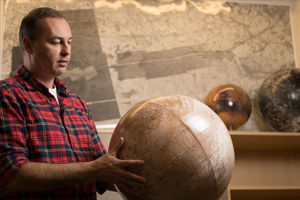
Structural geology professor Dr. Simon Katterhorn (Photo by Ted Kincaid / University of Alaska Anchorage)
As a structural geologist, UAA's Simon Kattenhorn knows all about this kind of geologic time. He's long been curious how, over millions of years, the earth's surface literally stretched and fractured into the tectonic plates we know today. These rift zones fascinate him and have fueled all of his extensive terrestrial research. He didn't stop with planet Earth, either; as a planetary geologist, he studies rifts on planets all around the solar system.
Most active oilfields occur in rift zones that formed before the tectonic plates drifted apart, and then become buried in sediment along the edges of continents, thousands of feet below Earth's surface. Kattenhorn's understanding of structural geology make him valuable to the oil industry the world over. His fault study sites have included the East African Rift Valley, Iceland, Egypt, the western United States, northern Alaska and Australia.
After his 16 years at the University of Idaho and before arriving at UAA in July 2016, he actually worked in the oil industry for two years, at ConocoPhillips. Out of their Houston office and with frequent trips to Anchorage, he helped analyze one of their many North Slope 3D seismic data sets. He hadn't had an opportunity to work on a data set like that since he'd been a graduate student at Stanford University, back in the 1990s.
But in a recent interview about his 2018 ConocoPhillips Arctic Science and Engineering Award (CPASE) - when Kattenhorn commented on the luck of timing - he literally meant the sudden availability of formerly proprietary seismic data from Alaska-based oil companies. He, and UAA, are uniquely positioned to take advantage of this new information flow.
Seismic studies cost millions of dollars to undertake. Oil companies keep this information proprietary to protect their investment. But the State of Alaska requires projects that have benefited from Alaska tax credits to share seismic data 10 years after its collection, hoping to entice smaller oil companies who can't afford such studies to use them and explore for oil in Alaska.
Real-world, real-time opportunity
The first-ever release under the state requirement came in late 2016, just after Kattenhorn had arrived at UAA. It included publication of a single 3D seismic survey from the North Slope, known as STORMS 3D. A 3D seismic survey provides a detailed three-dimensional picture of the subsurface of the Earth down to depths of many thousands of feet, allowing geologists to make interpretations of the types of features that may be important for the discovery of oil reservoirs.
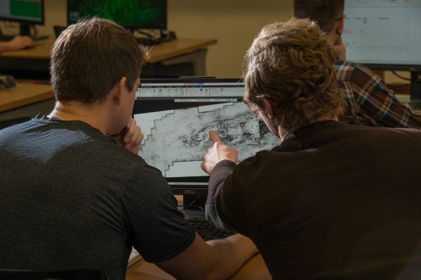
Geological sciences graduate students Triffon Tatarin, left, and Brock Rust, right, map and model underground geologic features. (Photo by James Evans / University of Alaska Anchorage)
With funding from their 2018 CPASE award, analyzing STORMS 3D will allow Kattenhorn and his graduate student, Triffon Tatarin to get a much better grip on the geologic underpinnings of about 400 square miles of the North Slope, just south of Prudhoe Bay and not far from ConocoPhillips' Kuparuk holdings. The $80,000 award will fund Tatarin's 2-year master's degree, with Kattenhorn, UAA petrophysicist Shuvajit Bhattacharya and a ConocoPhillips structural geologist comprising his thesis committee.
Kattenhorn is filled with questions about the North Slope's subsurface structure. What is the tectonic history of the area? How did the Beaufort margin and the Canada Basin (remember, the land masses that are now Alaska and Canada were once connected here) come to be? What are the implications for the North Slope oil field?
"It's clearly topical for the kinds of things the oil companies are interested in," Kattenhorn said. "And it would dovetail well with their own work in their producing fields." Kuparuk is one of ConocoPhillips' main assets on the North Slope. While STORMS 3D deals with adjacent territory, Kattenhorn hopes their findings will apply to nearby producing fields.
The roll out of industry seismic data continues today. The Alaska Geologic Materials Center in Anchorage houses them, as well as thousands of geologic core samples, and arranges for their sharing. Academic institutions like UAA enjoy free access to the information.
Right place, right time, for UAA
Not only is Kattenhorn's industry and research experience and capacity perfect for tackling this public domain data set, but UAA has the computational tools necessary to work with it - a rare concurrence at the university level.
Using another sizeable donation from ConocoPhillips, Kattenhorn and fellow geological sciences professor Jennifer Aschoff built the ConocoPhillips Geoscience Computational Laboratory last summer. Now UAA has 20 work stations equipped with state-of-the-art industry software needed to visualize 3D seismic data. In the past year alone, UAA has benefited from the equivalent of $130 million in software donations that make this analysis possible, according to Kattenhorn.
"We are giving our students the best top-of-the-line tools that they need to work with these kinds of data," Kattenhorn said. "These are tools they would be using or working with in industry."
Very few academic programs in the nation have such capacity, he said. "We are topnotch in that regard."
A boon for graduate students
Kattenhorn has mentored nearly 25 doctoral and master's graduate students over his career to date. A shelf in his CPISB office holds a hefty row of blue, bound volumes containing their theses. He's proud to have former students teaching in universities, working at the Smithsonian and NASA's Jet Propulsion Lab, or active in the oil and gas and geotechnical industries.
"This is what we do at the university," Kattenhorn said. "We educate students and help them develop their careers. I will do whatever I can to facilitate that."
Surprisingly, 3D seismic analysis - done mostly on computer screens - does not involve much field work.
"When you are actually on the surface north of the Brooks Range, you are on tundra and permafrost. All the rocks you are interested in are thousands of feet below the surface, formed in the Jurassic when dinosaurs were around. There's really nothing for me to see up there."
While the Brooks Range remains high on his personal bucket list, Kattenhorn has chosen a different location for his students' field work. "They still need context to understand what they are seeing on their computer screens," he explained.
So in early May, he'll fly them to Northern California for a look at a normal fault system called the Hat Creek Fault. Kattenhorn calls it "a great learning tool," and recently published a paper about it in an American Association of Petroleum Geologists memoir, called "3D Structural Interpretation: Earth, Mind and Machine," a book based around 3D cognition skills.
"That will be their field study," Kattenhorn said. "When you are looking at 3D seismic data, and you see something that looks like a little blip on the computer screen, here (Hat Creek Fault) is what you are looking at, in real spatial or scale context."
He expects his students to be awed by the experience. "I know when they look at that fault, their jaws are going to drop and they'll be wide-eyed," he said. "They'll say, 'Wow! I had no idea it was THIS BIG!'"
Written by Kathleen McCoy for the Office of University Advancement
 "UAA geologist Simon Kattenhorn: “Timing is everything.”" is licensed under a Creative Commons Attribution-NonCommercial 4.0 International License.