Geomatics B.S.
Explore the geomatics bachelor’s degree program at the University of Alaska Anchorage
Led by professionals with decades of teaching and industry experience, UAA’s rigorous geomatics program meets the Alaska State Board of Registration requirements for licensure.Faculty work closely with industry leaders to ensure the program offers the most up-to-date equipment and software available.
What you’ll learn
The geomatics bachelor’s degree program at UAA covers all the major disciplines of geomatics and geospatial sciences, leading to more employment opportunities for graduates.
Classes include extensive fieldwork and career development opportunities, with the campus and surrounding Alaska landscape providing an extended classroom as you learn about topics such as land surveying and geographic information systems (GIS).
Emphasis areas in the geomatics program
As a geomatics major, you can choose from three areas of emphasis: surveying, geospatial science and geo-developer (which focuses on computer programming for geospatial science). You can also choose electives outside your concentration to tailor a program uniquely suited to your interests and career goals.
Geomatics scholarships and financial aid
Get help with tuition and education expenses. UAA offers a variety of scholarships and other types of financial assistance that you can qualify for as a geomatics major. Learn more about financial aid opportunities at UAA.
Did you know..
UAA is home to the only geomatics program in the state of Alaska and one of the few programs in the country that offers education in all six disciplines in the field of geomatics.
What can you do with a geomatics degree from UAA?
UAA graduates are in high demand with recruitment opportunities in Alaska, the continental United States and worldwide. They work as professional surveyors, photogrammetrists, geospatial analysts, GIS managers, geospatial database administrators, geospatial engineers and more. Employers of recent graduates in Alaska include:
- Bureau of Land Management
- Alaska Department of Transportation
- Alaska Department of Natural Resources
- Municipality of Anchorage
- Mat-Su Borough
- Terrasond Hydrographic Surveying
- Resource Data Inc.
- HDL Engineering
- Lounsbury Engineering and Surveying
By the numbers..
Geomatics bachelor’s degree program highlights
The Bachelor of Science in Geomatics is accredited by the by the Applied Natural Sciences Accreditation Commission of ABET. The program prepares students to address Alaska’s needs in oil and gas exploration, mining, site development, land boundaries and environmental protection. The following are just a few of the unique opportunities you will have access to when you major in geomatics at UAA:
- Prepare for diverse career opportunities. UAA offers one of the few programs in the country that covers all major areas of geomatics and geospatial sciences.
- Get hands-on experience. As a geomatics major, you’ll gain real-world experience through internships, service learning projects, undergraduate research opportunities and explorative study abroad.
- Work closely with top faculty. Geomatics faculty bring decades of teaching and professional industry experience to the classroom, as well as international expertise and diverse backgrounds covering all geomatics disciplines.
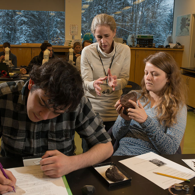
- Access cutting-edge facilities. You’ll get to work in two dedicated geomatics labs containing the latest equipment and software, supplemented by a remotely accessible server for distance learning.
- Take part in clubs, campus events and networking opportunities. These organizations include the Geomatics Student Association (GSA) – a group that is active both on campus and in the community, offering students a variety of leadership, volunteer and mentorship opportunities.
Geomatics bachelor’s degree program curriculum
The geomatics program curriculum covers topics such as land surveying, mapping, geodesy (studying the shape of the earth), digital photogrammetry (developing 3D measurements from photos), hydrographic surveying (surveying underwater), remote sensing (mapping from satellite data), LiDAR (laser scanning from airplanes), geographic information systems (GIS) and global positioning systems (GPS/GNSS).Top classes for geomatics majors
- Computer-Aided Drafting for Surveyors (surveying emphasis)
- Spatial Data Structures (geospatial emphasis)
- Object-Oriented Programming (developer emphasis)


